
Tracing a San Gabriel Street Directory
A street search works best as a chain. Begin with a full situs address, not a loose street name. The Assessor Portal can turn that address into an AIN and legal description. Map Search then places the parcel beside its neighbors. The recorder index is not keyed to a street, so the current assessee or owner clue becomes the name used at the Norwalk counter. City permits show work at the address, while voter and directory evidence can place a person there at a particular time.
The result is a set of supported facts, not a claim that every person on a block has been found. A deed proves a title event. A parcel card describes assessment data. A permit names an applicant or contractor. A directory records a publication snapshot. Keep each source and its date beside the address.
- Enter the full address in the Los Angeles County Assessor Portal and save the standardized situs, AIN, and legal-description clues.
- Open Map Search, zoom until parcel lines appear, and click the target and adjoining polygons one at a time.
- Use the assessee or owner clue, plus a likely year, to search the Los Angeles County RR/CC grantor-grantee index.
- Check San Gabriel eTRAKiT for permit, project, parcel, contractor, license, and inspection records tied to the address.
- Use the authorized voter channel or a library reverse directory only for a lawful, documented purpose and within its access limits.
San Gabriel Assessor Parcel Search
The county Assessor Portal accepts an Assessor Identification Number or a street address. Select the suggested result rather than assuming that a partial street string is the right lot. The Basic Search tab is the ordinary path. Legal Search helps carry a tract or lot clue when an address has changed, Map Search provides the geographic view, and Assessor Internet opens the assessment detail. The portal shows an “Assessor Records Effective” date and version, so the card describes a roll snapshot.
| Search field or mode | Type | Street use |
|---|---|---|
| Search by AIN or Address | Text or autocomplete | Find the standardized parcel |
| Basic Search | Mode | Run the normal address or AIN query |
| Legal Search | Mode | Follow legal-description clues |
| Map Search | Mode | Browse the street and adjoining lots |
| Assessor Internet | Mode | Open the assessment view |
A parcel result may list AIN, situs, legal description, use, year built, square footage, bedrooms and baths where maintained, lot size, land and improvement values, exemptions, and transfer references. It does not list every occupant, family member, utility subscriber, or person who visits the parcel. Owner or assessee information is only used as an anchor for the next source.
San Gabriel Map Search, Parcel by Parcel
Map Search is useful for building a street segment because the public method is geographic browsing, not a wildcard resident query. Locate one known parcel, zoom in until the outlines are clear, pan along both sides of the street, and click each polygon. Save the AIN and standardized situs for each selected lot. If a layer, legend, measure, or buffer control is visible, inspect its current behavior before describing it. The interface can change.
| Map control | What it supports | Caution |
|---|---|---|
| Search by AIN or Address | Navigates to a parcel | It is an address anchor, not a resident query |
| Zoom | Exposes parcel outlines and street context | Map scale does not create a legal survey |
| Pan | Follows a street segment | Keep a written list so a lot is not skipped |
| Parcel selection | Opens a mapped AIN or parcel view | One polygon may not equal one household |
| Layers or legend | Shows controls if the live viewer provides them | Do not assume zoning or buffer data |
The map establishes parcel geography. It does not establish a full street directory, and a multiunit structure can contain several units under one parcel or several parcels under one development.
San Gabriel Records Along One Street
Each address-keyed source answers a smaller question. The coverage table keeps those questions visible. It also shows why no single record should be presented as a complete list of San Gabriel residents.
| Address source | Keeper | What it can establish | Access |
|---|---|---|---|
| Assessor parcel | LA County Assessor | AIN, situs, property facts, possible mail clues | Free portal |
| Assessor Map Search | County map viewer | Parcel location and adjacency | Free browse |
| Recorded instrument | LA County RR/CC | Title parties, liens, dates, legal descriptions | Counter index, paid copies |
| eTRAKiT record | City of San Gabriel | Permits, projects, contractors, inspections | Free guest search |
| Authorized street index | LA County Registrar | Registration information within an allowed purpose | Contract and fee |
| Reverse directory | Library or regional shelf | Printed occupant or business at a snapshot | Reference request |
The AIN connects assessment and map work to the legal description in a deed. The street name connects map work to permits and any eligible street index. A reverse directory connects a printed address to an occupant clue. This is the practical architecture behind a San Gabriel street directory.
Situs, Mailing, and Legal Identity
Address terms can look alike while pointing to different facts. A careful street directory records all of them. The distinction is especially useful when a deed uses a tract and lot, the assessor uses a standardized situs, and tax mail goes somewhere else.
- Parcel
- A mapped unit of land identified by the assessor; it may contain a single structure, several units, or a development share.
- Situs address
- The physical location used by assessment and permit systems.
- Mailing address
- The destination for assessment or tax correspondence, which can differ from the parcel location.
- Legal description
- The tract, lot, block, or other land description carried in a recorded instrument.
- Criss-cross directory
- A reverse directory arranged by street and number so a reader can find a printed occupant before checking the name section.
A matching situs and mailing address can support an owner-occupancy clue, but it cannot prove who is present. A different mailing address may point to an owner’s correspondence destination, a trust, or an entity. The legal description is the most durable bridge when street numbers or names shift.
San Gabriel Permit Activity by Address
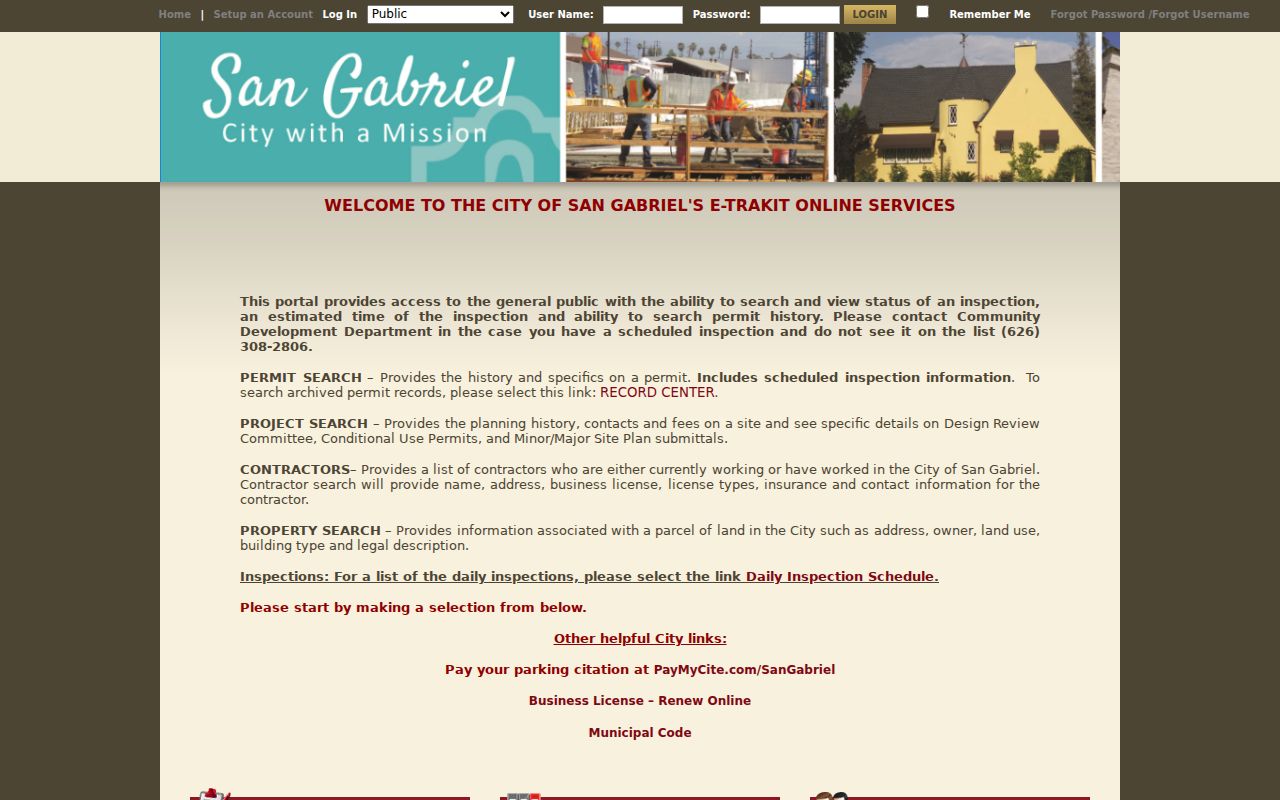
San Gabriel eTRAKiT adds a city-level work trail to the county parcel record. Public modules expose Permit, Project, Parcel, License, Contractor, and Inspection searches. The guest path is suited to basic retrieval; an account is used for applications or personalized actions. Search by the module’s offered address, parcel, permit, project, or contractor mode, then narrow with a date pair when the interface provides it.
A result can establish the site address, permit number or type, description, status, applied, issued or final dates, contractor, and inspections. It documents work at a site, not a complete resident list. Building and Planning walk-ins run from 8 to 11:30 a.m.; afternoon visits from 1 to 5 p.m. are appointment-only. City Archive files can fill an older gap, though complainant details and other protected material may be redacted.
The San Gabriel eTRAKiT portal shows how an address can connect a permit, project, parcel, contractor, and inspection history.
Permit chronology can bracket a physical change, but an application date is not a move-in date. Use it beside the deed, directory, and census evidence.
San Gabriel Deeds Have No Street Search
Los Angeles County’s recorder index is organized by grantor, grantee, and recording year. It has no address field and no public Internet index. The productive chain is address to AIN, AIN to current assessee or owner clue, owner to grantee entry, grantee to deed, seller to earlier grantee, and so on. Search the legal description on every candidate deed before treating a same-name result as the same parcel.
The physical index covers 1851-present. Material from 1851-1957 is in the Norwalk lower level; 1958-present is on the second floor. Copies can show parties, recording date, document number or book and page, instrument type, legal description, return address, and transfer indicators. The RR/CC says telephone index searches are not available. A counter search is therefore a primary access channel, not merely a last resort.
Note: Carry the AIN, tract, lot, block, legal description, likely owner, and likely year because the recorder cannot search a street address for you.
Reverse Directories for San Gabriel Past Occupants
A reverse or criss-cross directory inverts the normal alphabetical list. Start with the street and number, read the printed occupant or business, then find the alphabetical entry for occupation, spouse notation, or a cross-reference. Exact San Gabriel editions are not listed in the official online catalog, so ask LA County Library reference staff to verify the volume, geographic coverage, date, and abbreviation key. Do not copy a key from one publisher into another year.
Directories are publication snapshots. Compilation may happen before the printed year, and a missing name can mean a move, death, boundary change, spelling error, or omission. Search surname variants, initials, spouse names, occupations, and street numbers. The historical shelf and household tracing workflow are treated in depth on the San Gabriel directory book page.
San Gabriel Voter Data Is Purpose Limited
The LA County voter self-check is not an open street directory. It requires a last name, full birth date, house number, and ZIP Code. It is designed for a voter checking the voter’s own status. A broader street index or voter file is available only under an eligible election, scholarly, journalistic, political, or governmental purpose, a signed contract, and the county’s fee rules.
California Elections Code sections 2188 and 2194 restrict home address, telephone, email, precinct, prior registration, identification numbers, and signatures. Personal, private, or commercial browsing, solicitation, and broad republication are barred. A street directory must not imply that a voter file can be copied into a public neighborhood list.
Postal San Gabriel or City San Gabriel
A postal city line is not the same as an incorporated boundary. San Gabriel-associated ZIPs include 91775, 91776, and the special or PO-box-style 91778 use described in the research. Postal territory can extend toward adjacent communities, and a parcel near a city edge may carry a San Gabriel mailing identity while falling under a different permit custodian. Confirm the ZIP through USPS, then confirm the municipality through the Assessor map and the city or county record office.
The street directory should record postal address, situs, AIN, and jurisdiction as separate fields. Do not use a ZIP label to infer a city line, a neighborhood, or a list of people.
San Gabriel Multiunit Parcels Need Care
One parcel is not one household. A condominium or other multiunit development may have several parcels, while a larger structure may be represented by one assessment parcel. The map shows the county’s parcel geometry, not a unit roster. An assessor card may display property characteristics or an owner clue without showing every unit, occupant, or family member.
For a multiunit address, retain the unit label, AIN, legal description, permit or project number, and the source date. Ask the city whether the permit or address record is tied to the whole site or a particular unit. If the research question is one person rather than one street, move to a person-specific record path instead of turning parcel geometry into a resident claim.
What San Gabriel Street Directory Cannot Show
No public source reviewed supplies every person who lives on a San Gabriel street. Household members, utility subscribers, delivery records, and motor-vehicle address data are not open substitutes. A deed identifies title parties. A permit identifies project participants. A reverse directory may omit a household. A voter record has statutory purpose limits. The honest street directory states what each record can and cannot establish.
Lawful use. Address and parcel records may support personal research, family history, property curiosity, and civic work. Do not use a name or address clue to stalk, harass, intimidate, or harm anyone.
When a record is wrong, contact the custodian that created it. The county Assessor handles assessment issues, RR/CC handles recorded and vital files, the court handles a case index, and San Gabriel handles its city permit or archive material.